North Carolina’s General Assembly passed new legislative maps on November 6, and there’s already a lawsuit about them. Why are we redistricting, what role does the census play, and how is Carolina Demography educating people about the process?
Every 10 years, states create new legislative boundaries with brand new data from the decennial census to ensure there are equal amounts of people in each region. North Carolina has a checkered past with legislative maps. The state court renounced North Carolina’s legislative districts in 2019, finding the partisan gerrymandering violated the state constitution. Those maps had already been redrawn in 2016 when the previous maps were found to unconstitutionally use race to determine district boundaries.
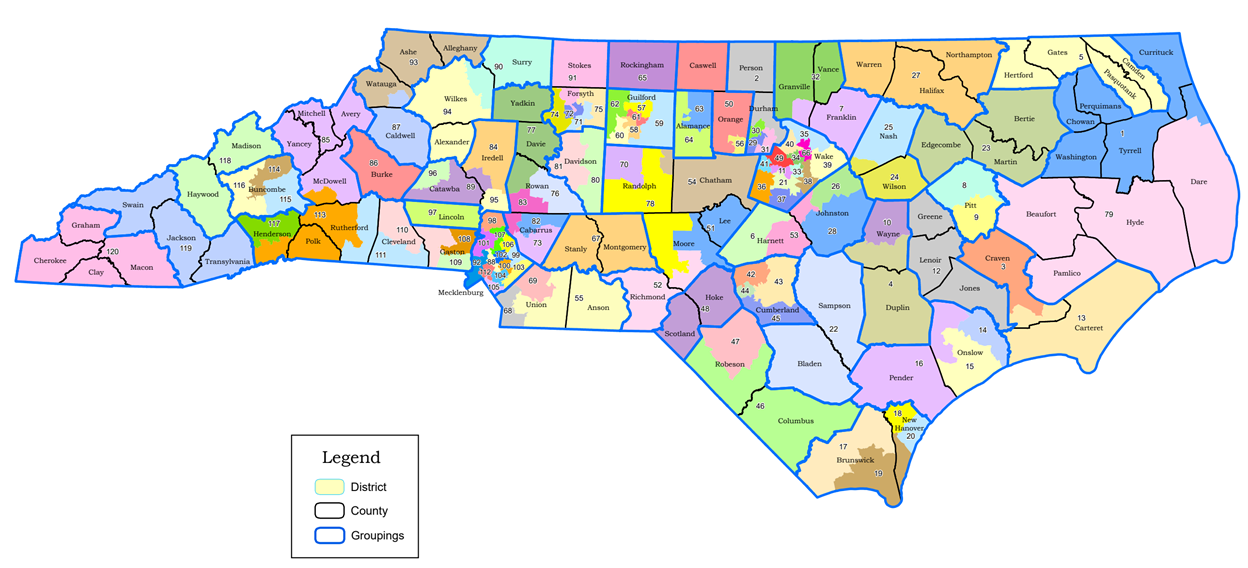
On Nov. 5, a Republican-led state House and Senate passed new voting districts with four Congressional districts, 50 state Senate districts, and 120 state House districts. The next day, a group of voters filed a lawsuit contesting the latest legislative maps.
Redistricting is a complicated process where legislators have to consider population growth, demographics, and geographic lines.
“The biggest issue with respect to redistricting is ensuring equality of population across districts,” Director of Carolina Demography Rebecca Tippett says. “Population growth occurs unevenly. For example, our state’s urban areas have been growing faster than rural areas. This jeopardizes the principle of ‘one person, one vote.’”
That’s why redistricting occurs when census data is released. The census is an official source of population data regulators use to ensure all regions have an equal voice. Balancing densely populated urban areas and spread-out rural areas is a challenge legislators must overcome in this process.
Tippett calls the census “the building blocks of redistricting.” It’s one of the reasons why it’s imperative to participate in the census. An inaccurate count of the population could lead to unequal legislative districts.
In North Carolina, there are 120 state House, 50 state Senate, and 14 U.S. Congressional districts. Each set of districts has an “ideal size” determined by the state’s population — 10,439,388, divided by the number of districts. Population of state house and senate districts can vary 5% over or under that ideal size.

While general population is the most important fact to consider when redistricting, some have discussed the need to keep counties as whole as possible. Tippett says “communities of interest” are considered when creating legislative districts, and counties are one way to determine them.
“Communities of interest are, quite simply, a group of people who share a common interest. This common interest may lead to similar legislative concerns, meaning that they benefit from being able to have shared representation and not having their representation fragmented.”
Tippett says Carolina Demography, housed in the Carolina Population Center, mainly aims to educate people on the process of redistricting, from the census to creating the districts to the data and technical aspects of the process. After all, districts are a fundamental part of our elections that can seem mysterious behind opaque curtains of political machinery.
“The district one is in determines which candidates one votes for,” Tippet says. “And, depending on how that district is drawn, it may determine how likely it is that you will be able to elect a candidate that matches your preferences.”
Rebecca Tippett is the director of Carolina Demography within the UNC Carolina Population Center.