Alexis Longmire is exploring how manmade coastal barriers affect predator movement, seagrass, and the future of waterfront communities.
As the setting sun bursts with color over the estuary behind Pine Knoll Shores Aquarium in Morehead City, North Carolina, Alexis Longmire’s attention is on the water. Her team has just netted a silver- and black-striped fish that sounds like it’s purring. This predator is called a black drum, aptly named for its throaty thrum.
“We need to keep this one for tomorrow,” Longmire says.
They take its measurements, add the data to their notes, and carefully guide the netted fish — which the research techs name “Geoff” — into a bucket surrounded by bubblers to oxygenate the water. This will be his hangout spot for the rest of the evening.
For the next three hours, the team methodically checks their nets, hoping to catch more predators. As they wade through the lukewarm marsh water, they shuffle their rubber-booted feet along the sandy seafloor to avoid startling nearly invisible, burrowed stingrays that could strike defensively with their barbed tails if stepped on.
By the time the researchers finish their surveying, the coastline is dark, and the sky is full of stars. They use headlamps to navigate back to shore through the waist-deep water, taking Geoff with them for an overnight in the lab. They’ll return him to the estuary tomorrow for part two of the project.
Impact Report

The UNC Institute of Marine Sciences (IMS) offers immersive research experiences that connect students and scientists with N.C.’s coastal ecosystems and communities. To date, IMS has trained 500+ undergraduate and graduate students.

IMS research shows that roughly 15% of U.S. shorelines are reinforced with vertical walls that offer little ecological benefit. The institute is exploring sustainable alternatives like living shorelines, which use natural materials to reduce erosion and support marine habitats.

Tracking predators
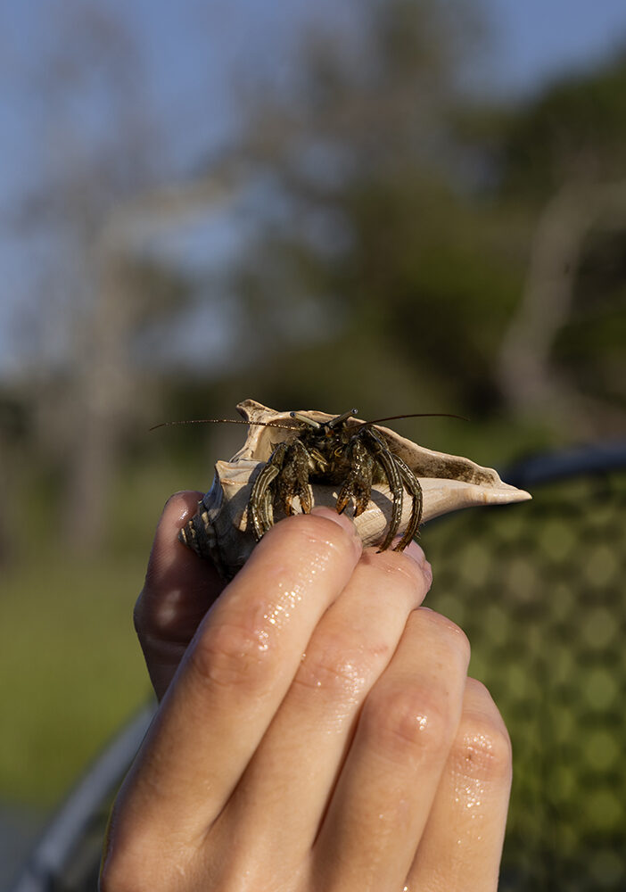
As a PhD student at the UNC Institute of Marine Sciences (IMS), Longmire is tracking marine predators — like black and red drum, speckled trout, flounder, and stingrays — to better understand how they move along living shorelines.
Built from mostly natural materials, these manmade structures are designed to protect the coast from erosion, filter pollutants from stormwater runoff, and provide vital habitat for marine life. They are an eco-friendly alternative to barriers made of concrete and metal, which don’t support biodiversity.
In 2024 alone, the N.C. Coastal Federation installed over 240 of these shorelines. The U.S. Army Corps of Engineers mandates a 10-foot gap for every 100 feet of structure to create passageways for marine life to move freely. Longmire wants to know if these gaps are effective, especially as living shorelines are increasingly used — even encircling entire islands.
The 4,214-foot living shoreline that Longmire is studying in Bogue Sound resembles a series of low stone-like walls stretching between the marshlands and the sound. Constructed from specialized materials developed by N.C. companies to attract oysters and provide fish and crab habitat, the structure is designed to blend with the natural environment. Gaps between each segment allow fish to move freely between the marsh and the sound — an essential connection, as the marsh provides critical food, shelter, and breeding grounds.
Longmire’s research focuses on predators because they sit at the top of the food web. Disruptions to their movement can trigger ripple effects throughout the ecosystem. These fish also support both commercial and recreational fisheries, as many are sought after for sport and for food.
“We have a very productive estuary here, and people come from all over the country to fish it,” Longmire says. “And not only are these fish commercially and economically important, but they’re ecologically critical as well.”
As Longmire drives the team back to the institute, she outlines her plan for the long day ahead. It’s early in her data collection, but she’s determined to uncover whether these structures are truly helping marine ecosystems thrive — or quietly reshaping them in ways we don’t yet understand.
Mapping marine movement
The next day, Longmire meets four IMS research technicians in the lab. Two of them were part of last night’s field work, and the other two are joining because today’s project demands more hands.
“I rely heavily on my lab mates, friends, and colleagues,” Longmire says. “That’s the sort of community that IMS is. It’s very collaborative. And everyone really cares about these animals, these systems. They are personally invested.”
In the lab, the team prepares their sensors, swapping out batteries and ensuring each device is properly synced with the computer software that will log their data. In the field, they’ll attach the sensors to PVC pipes and drive them into the seabed near the living shoreline. They will track fish that have been fitted with corresponding tags, much like how GPS devices monitor the movement of vehicles along a route.
With everything ready, they load the boat with gear, the black drum named Geoff, and a tail-less stingray affectionately called “Stubby.” Longmire takes the helm, guiding the boat across Bogue Sound. Salty wind and waves rattle its contents, and threaten to displace hats, but before long, the team arrives at the field site.
The coastline looks completely different from the previous evening. The tide is at its lowest, revealing the full extent of the living shoreline: a low wall dotted with oyster shells. The water is clear, the seabed visible, and the stingray pits easy to spot.
Longmire eases the boat in and drops anchor. The team hops out and gets to work.
They carry a 400-foot net toward the shoreline, using it to enclose a 35,000-square-foot area. With mallets, they secure the net’s stakes into the seafloor, then set up the acoustic sensors. Once the tide rises to just above their knees, they attach the tags to Geoff and Stubby and release them into the fenced area.
Over the next 24 to 48 hours, the predators will move through the space, generating valuable data for Longmire to analyze — data that could reveal how these animals interact with living shorelines and whether these structures are helping or hindering their natural behaviors.
Longmire and her team repeat the tagging and tracking process several times a week. The goal is to collect enough data from a variety of species to determine how fish navigate the living shorelines — and whether the 10-foot gaps built into these structures truly allow them to move freely.
Assessing seagrass
Longmire’s research isn’t just about predators. She’s also assessing how living shorelines might impact nearby seagrass beds. In North Carolina, living shorelines are rarely built near seagrass beds due to regulations that require a 30-foot buffer between the land and water.
“The site at Pine Knoll Shores Aquarium gives us a rare chance to study how living shorelines affect seagrass in real time,” Longmire explains. “That 30-foot buffer isn’t backed by science, but people are understandably cautious about harming these already fragile ecosystems.”
To monitor the health of these underwater meadows, Longmire combines aerial photos with on-the-ground surveys. In the field, she tracks changes in seagrass type, coverage, and growth. She also measures how high the beds sit and how far they are from shore to determine how waves and sediment shape their location.
Seagrass plays a critical role in coastal ecosystems, serving as a nursery habitat for countless marine species. Just 100 acres can support 80,000 fish and 100 million small invertebrates, including rare and endangered species. North Carolina is home to 100,000 acres of seagrass, the second-highest acreage along the East Coast. But in the last two decades, about 6,000 of those acres have died off.
“We are losing seagrass at a rate higher than the global rate of seagrass loss,” Longmire says. “I think that everyone has a stake in protecting seagrass in North Carolina.”
Engaging communities
That sense of shared responsibility is something Longmire actively cultivates. She often shares her research with the public through the N.C. Coastal Federation, a nonprofit dedicated to protecting and restoring the state’s coast. Through the organization, she engages with local engineers, homeowners, and park staff to help them better understand the science behind shoreline restoration.
She also enjoys connecting with younger audiences. At a recent marine science camp for elementary and middle-school students, Longmire provided a hands-on look at her research setup at IMS. They helped her organize netting, learned how the fish-tracking sensors work, and even watched her tag a drum — who they named “Billy Bob.”
Once Billy Bob’s data is analyzed, Longmire plans to send the results back to the students so they can follow the experiment from start to finish.
“It’s important that kids recognize that they don’t have to aspire to be scientists but can already be scientists,” she says.
That same sense of curiosity and care extends to the broader community.
“Whether you’re sitting at a restaurant or driving along the coast, you’ll see one of these living shorelines,” Longmire says. “People here recognize them, and they’re invested in learning more.”
Alexis Longmire is a PhD student at the UNC Institute of Marine Sciences, which is part of the Department of Earth, Marine, and Environmental Sciences within the UNC College of Arts and Sciences.