
What would you say if you found out that North Carolina were disappearing? That one day Wilmington or the Outer Banks just crumbled into the ocean, never to be seen again? In Greenland — the largest island in the world, made almost entirely of ice — that’s exactly what’s happening, says UNC seismologist Jose Rial.


Every day, huge, building-sized pieces of Greenland’s ice sheet melt, crack, and break off into the sea. The ice cap is like a giant cathedral, with the areas nearer to the ocean acting as buttresses, holding the middle in place. If those buttresses crack and collapse — and they are doing so, as you read this — the entire structure will fall apart rapidly, sending the rest of the ice cap crashing down into the ocean.
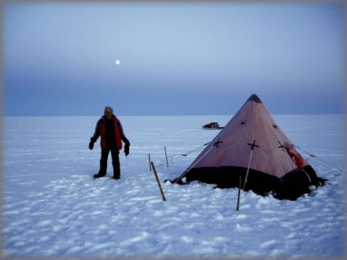
Just before the warming season began in mid-May, 2006, Rial stepped out of a tiny airplane called the Twin Otter, and unloaded his gear into Swiss Camp, a three-tent research station near Greenland’s western coast. Over the next month, Rial planted small but sensitive seismic sensors all around the camp, hammering their long spikes deep into the ice so they’d stay put after the three feet of snow he was standing on melted over the summer. When he went back in August to retrieve his data, Swiss Camp looked like Venice and he had to take a helicopter in. But now he knows the strength and location of every earthquake in a one-hundred-mile radius. And these small earthquakes may reveal the effects of increasing global warming on the ice sheet, he says.
By last count, Greenland is moving about one hundred and fifty cubic miles of ice to the ocean every year. The entire ice sheet naturally and constantly flows outward from the center of the country, where the snow piles thickest and highest and never melts. Contrary to popular belief, ice is rather fluid, Rial says. And when the weight of Greenland’s continuous snowfall compacts it, the ice squeezes out the sides of the island, eventually dropping into the ocean. This squeezing forms coastal glaciers (rivers of ice) that then flow into the ocean, breaking off into giant pieces — icebergs the size of large buildings — in a process called calving.
When the ice shifts around in large masses, it cracks, producing hundreds of micro-earthquakes. And that’s what Rial is listening for. Each of his stations, powered by solar energy and batteries, records the earthquake’s motions — vertical, east-west, and north-south — and exactly when it occurs. Based on the time stamps, Rial can use triangulation to figure out where the earthquake started. “Accurate timing is crucial,” he says. “You’re measuring hundredths of a second. You have to have the right time — exactly — because you’re synchronizing several stations to determine the earthquake’s location.”
But if the ice sheet normally squeezes pieces of itself out into the ocean every year, why does Rial say he’s studying global warming? Could the seismic activity be just run-of-the-mill melting? No one can say for sure.
The difference, Rial says, is that these quakes are more powerful, frequent, and longer (some lasting from two to ten minutes) than the micro-quakes that accompany your average seasonal melt. And many of them — a disproportionate number — are concentrated in the Jakobshavn Glacier on Greenland’s west coast, the fastest-moving outlet glacier in the world. “The number and intensity of the glacial quakes there has increased dramatically in the last five years,” Rial says. Five years ago, Jakobshavn’s calving front — the area where the glacier starts shedding ice — was twelve miles closer to the water. That’s twelve miles of ice that melted away — and it’s no coincidence, he says.

“We know that there have been enormous warming events in the past hundred thousand years, much larger than the one now,” he says. But ice core measurements of those temperature changes tell us that temperature and CO2 go hand in hand — when one rises, so does the other. And right now, “We have levels of CO2 that are way, way above anything in the last two million years. And this rise happened in the past two decades.”
Now that Rial knows that Jakobshavn is the seismic hot spot, he hopes to find out the nitty-gritty about what’s going on there. His plan: fly to the glacier in May, 2007, and plant sensors as close to it as he can physically get. The exact location, though, will be unknown until he gets there. Jakobshavn is notoriously dangerous, riddled with deep crevasses that come out of nowhere, and planes can’t land directly on it. “And you can’t use a snowmobile there,” Rial says. “You’ll fall in a crevasse and die.”
Their only hope will be a helicopter, and they won’t be sure that can land until they get there and survey the territory firsthand. So Rial may have to be dropped off while his transportation hovers above him. Right now he’s depending on global positioning system photographs and Google Earth to find his way, and hoping for a good spot on a nearby rock. If he can place the sensors closer to the action, his measurements will be more precise, and he can get clearer pictures of the big quakes — the ones that last minutes instead of seconds. “Those are the ones,” he says, “that indicate large chunks of ice are sliding.”
Jose A. Rial is a professor of geological sciences in the College of Arts and Sciences. He collaborates on SMOGIS (Seismic Monitoring of Greenland’s Ice Sheet) with Jay Zwally of the National Aeronautics and Space Administration (NASA), and Koni Steffen of the Cooperative Institute for Research in Environmental Sciences at the University of Colorado at Boulder. SMOGIS receives funding from the National Science Foundation and NASA.