
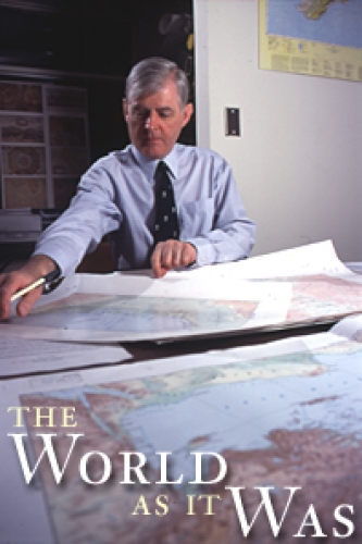

Welcome to Richard Talbert’s island. It’s not big or exotic—just two long, empty tables in the middle of his office.
But Talbert’s island is threatened from all sides. Racks of cubbyholes loom up on the left. Mailing tubes are ricked around the room like firewood. Cabinets bulge with rows of drawers. And everything, down to the last tube in the last cubbyhole, holds a map.
Flat maps spill from the drawers. Curled maps nestle in rows on the floor. Sets of maps flow down the walls. Old maps. Greek maps. Russian. Talbert, professor of history, sifts through drawers as he talks, bringing out another map, or three, to clarify his points.
Soon we’re awash in table-sized maps. The island’s gone under. I rescue my clipboard and recorder a few times, then give up and let them go. “I tidied up before you got here,” Talbert confesses.
Talbert needs this many maps. He’s editing the Barrington Atlas of the Greek and Roman World. Has been, in fact, for twelve years. This fall the atlas will finally be published. People are getting excited. A lot of them—historians, classical scholars, students, philologists, readers of the Bible, military buffs—have been holding their breath for a long time.
Why? Well, we can’t fully understand the world of the Greeks and Romans without good maps—maps that show us their world. To enter that world, we need to see the landscape as it was 2,000 to 3,000 years ago.
“But the sad fact is that maps of this type do not exist,” Talbert says. Sure, there’s Smith’s Atlas of Ancient Geography Biblical and Classical. But it was published in 1874.
“Now let’s see,” Talbert says, hurrying off to rummage through a pile in the corner. “Ah, yes.” He cradles a broad, heavy book to the table. Bound in green leather, its pages are edged in gold and starting to crumble. It’s Smith’s 1874 atlas.
Smith’s maps are breathtaking, with land contours more spidery and precise than the etching on a dollar bill. “You have to realize that to make this map took the best part of a year,” Talbert says. “One man engraved the landscape; another did the lettering. Then the maps were colored by hand. Just think of it!”
So you won’t likely find Smith’s atlas at the corner bookstore. What’s more, we’ve learned a lot about the classical world since 1874. “That book is a staggering achievement, but our knowledge and technology have far surpassed it,” Talbert says.
So why not create a successor to Smith’s atlas? Plenty of folks have tried—and failed, largely. In the 1920s, a handful of European nations gave it a shot. They’re still puttering along today, bickering over map scales and modern country borders, while releasing their maps one sheet at a time. A given region can only be mapped by the country now controlling it—and each country is unwilling to map beyond its modern boundaries.
So it goes for other atlas projects. Two started in the 1960s, one German and one Austrian. At around $3,000 a set, they’re “fabulously expensive,” Talbert says. Even so, he feels they’re trying to do too much—they map cultural, political, and social movements. Talbert points to one map loaded with color-coded symbols. “Look at this,” he says. “You’ve got railways running all over the place—not exactly features of the Byzantine landscape.”
So in 1988, after establishing that maps available for classical studies were “utterly disastrous,” the American Philological Association asked Talbert to take over the production of a new classical atlas. Millions of dollars would have to be raised. Hundreds of thousands of facts would have to be checked and rechecked. Scholars from all over the globe would have to be recruited—and someone would have to make them cooperate. “Failure on all fronts was almost a certainty,” Talbert says.
He took the job.
“Mind you, I’ve never been out to pick holes in these other projects,” he says. “They’re doing new and important research, but they’re doing it in a traditional way. They’re not really giving us the chance to see the ancient world, from a map perspective, as well as we could.”
That’s what this new atlas is all about.
Talbert knew enough not to make the same mistakes as others. The atlas, he decided, would not be a series of loose sheets. He would make a book. That way, the maps would be consistent in scale, projection, and features—and the project would actually get finished. The atlas would be essential for scholars and libraries, but Talbert realized it should have broader appeal. So he insisted that the book remain affordable.
He also enlisted professional cartographers from the outset. “If I know anything, I know the depth of my own ignorance,” he says. “A classical person, a historian—that’s what I am. When I foolishly embarked on this project, I realized I’d need professional help.”
He’s not kidding. With 102 maps spread over 180 pages, the atlas covers a lot of ground. It concentrates on the world of the Greeks and Romans from around 1000 B.C. to A.D. 640—not only the lands they lived in or conquered, but anywhere they might have traded or traveled. “We’re showing their world in far more depth and breadth than anyone has before,” Talbert says. “We’re going much further up the Nile; we’re going properly into the Baltic, India, Afghanistan, and so on.”
So Talbert divided the Greek and Roman world into 10 zones and appointed a coordinator for each. He titled these 10 scholars ‘vicars.’ “In Roman times,” Talbert says, “a vicar was a boss of a group of provinces—he had a set of governors under him. So while some of my colleagues were rather shocked to be addressed as ‘vicar,’ it was actually quite an appropriate title.”
Vicars helped to identify 74 experts who would compile maps for the atlas. Then they pushed their experts to do a thorough job—and to finish. “Not least because I told every vicar that if one of his team didn’t complete, I would expect the vicar to pick up the work,” Talbert laughs.
Eugene Borza, professor emeritus of ancient history at Penn State, compiled maps of Macedonia and Thrace for the atlas. Borza had to reconstruct a landscape that has weathered over 3,000 years of change—lakes appear or dry up, rivers change course, coastlines are in constant flux. But that might have been the easier part of his job: “As one might expect,” Borza says, “the language obstacles were daunting, as the literature appears in ancient and modern Greek, Latin, English, German, French, Serbo-Croatian, Macedonian, Bulgarian, and Turkish.”
Those obstacles are documented in the 1,400-page Map-by-Map Directory included with each atlas. Also to be issued on CD-ROM, the Directory will give further information about every map—a bibliography of works cited, a list of every name and feature on the map, data on periods of occupation, modern place names, and the like.
So what do we stand to learn from this atlas?
First, it will enable us to make connections we perhaps haven’t before. “Think of the eastern Aegean,” Talbert says, “where the islands today are in Greece, but the mainland is in Turkey. Scholarship on those areas has remained in two quite separate compartments.” But the atlas is doing away with all that.
Second, the atlas will show us just how broad and diverse the classical world is. “We can’t focus on Greeks just around Athens,” Talbert says. “Heck, no! The Greek world is much bigger and more diverse than that. That’s an important lesson for us in the twenty-first century, when we’re trying to be more diverse and look further than we once did.”
Third, the atlas will draw attention to areas of the Greek and Roman world that have been neglected. “Some of those are for obvious reasons—not many of us have penetrated Libya, for instance, because it’s full of unexploded land mines and that kind of thing. Fair enough.
However, there are very obvious places you might think were well researched. But they haven’t been. That’s been shown up by the atlas.”
Most importantly to Talbert, the atlas isn’t just for scholars.
“If you’re gripped by Hannibal and want to sort out which way you think he went through the Alps, you’ll have enough of a clear landscape to do it. If you want to follow St. Paul around the eastern Mediterranean, you can. If you want to locate your country villa in Tuscany in relation to the ancient landscape, you can.”
Talbert recently visited Italy, where the atlas is being printed. With twelve years’ work in the can, what does he now find most rewarding? “I think the fact that the project has actually survived,” he says. “It was very rewarding, I can tell you, to see the sheets coming off the press in Italy. Because the odds on this atlas succeeding were very, very slim.”
Twelve years of poring over the minutiae of ancient landscapes have given Talbert a keen eye for ways the world has changed.
“Take my own home county of Kent,” Talbert says, opening the atlas to what is today England. He points to a large island off the southeastern coast. “This island is now connected to the mainland,” he says. “There’s no island off Kent today.”
Which reminds Talbert of one thing his atlas isn’t good for.
“Please,” he says, “don’t try and drive with these maps. You’ll get into real trouble.”